New business coming early 2026, but for now feel free to tour our website
Drone Crop Analysis and Mapping Services
Crop Analysis & Field Intelligence by Drone
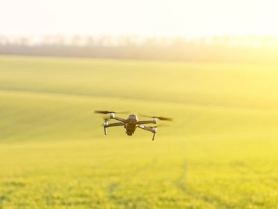
Our drone technology-driven crop health analysis services provide you with clear, actionable insights into crop health, establishment, and performance across every hectare. By utilizing high-resolution RGB and advanced multispectral sensors, we empower farmers and agronomists to make faster, more accurate decisions—saving time, inputs, and maximizing yield potential.
Unlike satellite imagery, our drones operate below cloud cover, delivering precise field intelligence exactly when you need it.
What We Analyse

🌱 Crop Health & Vigour (NDVI & Multispectral)
.Identify stressed, underperforming, or nutrient-deficient areas through crop health analysis. .Utilize drone technology to detect disease pressure before it’s visible to the eye. .Leverage field intelligence to compare crop performance across different fields or zones.
🌾 Plant Counts & Establishment
Accurate early-season crop health analysis allows for the identification of poor emergence, pest damage, or drill issues. Utilizing drone technology, this method provides essential field intelligence, making it ideal for cereals, OSR, maize, and cover crops.
🟢 Variable Performance Zones
Highlight areas with high- and low-yield potential through advanced crop health analysis. Leverage drone technology to support variable-rate nutrition, biostimulants, or PGR decisions. This approach provides ground-truth data for agronomists, enhancing field intelligence and input planning.
🚜 Tramlines, Compaction & Damage
Utilize drone technology for crop health analysis to identify missed tramlines, overlaps, or wheel damage. This advanced field intelligence can help spot compaction or traffic stress that may not be visible from ground level.